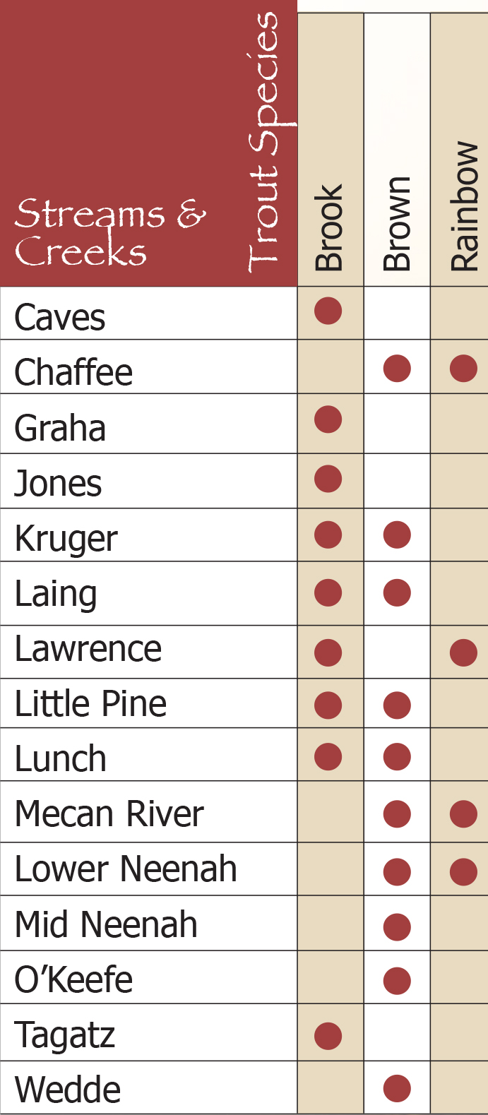
The Mecan River Fishery Area contains some of the finest trout streams in central Wisconsin. The waters are generally crystal-clear and support excellent natural trout reproduction through 31.1 miles of the total 48.7 miles of stream length. Chaffee and Wedde Creeks and the Mecan River are three of only a few streams in the entire state that have naturally reproducing rainbow trout populations.
For more information click here
John A Lawton Fishery Area (Tagatz Creek)
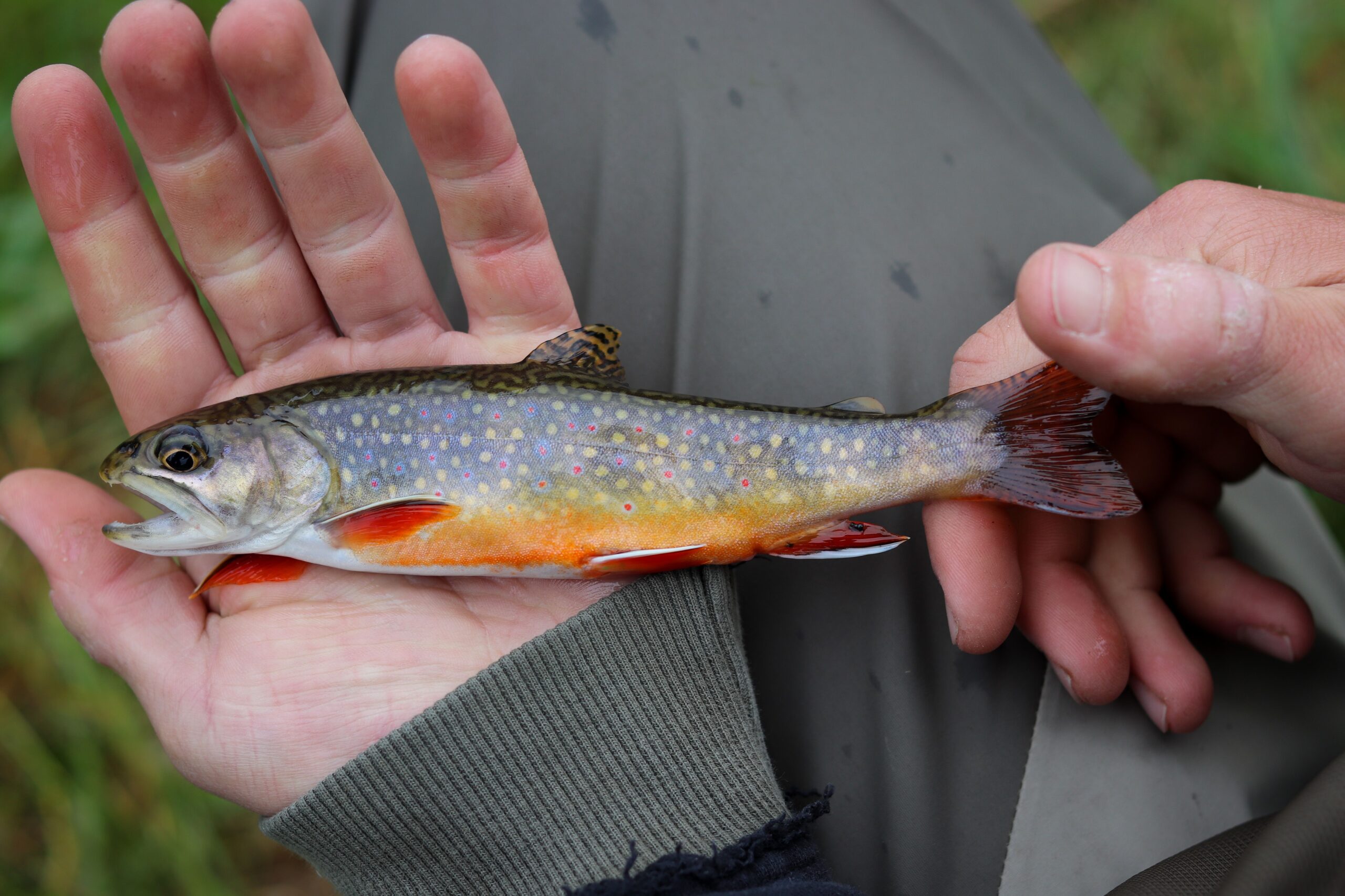
John A Lawton Fishery Area (previously named Tagatz Creek Fishery Area) is located in the northwestern quarter of Marquette County. The clear, spring-fed waters of Tagatz Creek have natural brook trout reproduction throughout its 16.2 miles of trout stream length. Tagatz Creek is known as one of the better brook trout streams in southern WI.
For more information click here
Caves Creek Fishery Area
Caves Creek Fishery Area is high quality trout water. The waters are generally crystal clear. There have been stream bank improvement projects throughout the system enhancing the already excellent fishing opportunities. The state ownership is 823 acres of fragmented parcels stretched along the stream’s 14 mile corridor. Some of the acres are held in perpetual easement intended to protect the stream shorelines and provide access to fisherman.
The clear, spring-fed waters of Caves Creek have areas of natural brook trout reproduction throughout its 12.1 miles of stream length. Caves Creek is regarded as one of the better brook trout streams in southern Wisconsin.
Click here for more information
Lawrence Creek Fish and Wildlife Area
Lawrence Creek Fish and Wildlife Area is a 961 acre parcel surrounding Lawrence Creek and it’s headwaters. It’s located in the northwestern part of Marquette County and east-central Adams County. The stream is high quality trout water. The waters are generally crystal clear. There have been various stream bank improvement projects within the stream enhancing the already excellent fishing opportunities.
Driving Directions
From the intersection of County Highways A and E in Lawrence, go north on A 0.8 mile, then west on Eagle Avenue 2.5 miles to a parking area north of the road. A trail leads north to the creek